Climate · Distances · Mountains · Rivers

Morocco Geography Guide: Weather, City Distances, Mountains & Rivers

Morocco covers 710,850 km² of North Africa with 3,500 km of Atlantic and Mediterranean coastline, four mountain ranges crowned by 4,165 m Jbel Toubkal, and the 1,200 km Draa river. Everything you need to plan the trip — distances between every imperial city, monthly weather by destination, elevations, and the best time to visit each region.

🗺️
Total Area
710,850 km²
🌊
Coastline
3,500 km
⛰️
Highest Peak
Jbel Toubkal 4,165 m
🏞️
Longest River
Draa 1,200 km
🌍
Climate Zones
4 Distinct Regions
Country Overview

Morocco at a Glance: Where Africa Meets Europe

Morocco sits on the northwestern tip of Africa, separated from Spain by the ten-mile-wide Strait of Gibraltar. It is bordered by Algeria to the east, Mauritania to the south, the Mediterranean Sea to the north, and the Atlantic Ocean to the west. The country covers roughly 710,850 km² (275,000 sq miles) — slightly larger than California and Oregon combined — and spans four distinct climate zones, from sub-tropical Atlantic coast to alpine High Atlas and arid Sahara.

Three great mountain ranges — the Rif, Middle Atlas, and High Atlas — divide the country into the Atlantic plains, the interior plateau, and the desert south, giving Morocco one of the most varied landscapes in the Arab world. The climate is mild along the coast, hot and dry in the interior, and snow-covered in the High Atlas peaks for several months a year.

Capital
Rabat
Population ~580,000
Largest City
Casablanca
Population ~3.7 million
Currency
Moroccan Dirham (MAD)
1 USD ≈ 10 MAD
Languages
Arabic & Berber
French widely spoken
Time Zone
GMT+1
Year-round (no DST)
Driving Side
Right
International permit recommended
Distances Between Cities

Driving Distances Across Morocco (Miles / Kilometres)

Driving distances between Morocco's main destinations — useful for planning the pace of your itinerary. We never recommend more than 5–6 hours behind the wheel in a day; for longer legs we add a stop, a scenic route, or split the journey across two days.

From / ToAgadirCasablancaErfoudEssaouiraFesMarrakesh
Agadir317 / 511428 / 690107 / 173469 / 756169 / 273
Casablanca317 / 511401 / 646218 / 351179 / 289148 / 238
Erfoud428 / 690401 / 646463 / 746287 / 462354 / 570
Essaouira107 / 173218 / 351463 / 746397 / 640109 / 176
Fes469 / 756179 / 289287 / 462397 / 640300 / 483
Marrakesh169 / 273148 / 238354 / 570109 / 176300 / 483
Meknes459 / 740142 / 229275 / 444360 / 58037 / 60290 / 467
Ouarzazate233 / 375274 / 442227 / 366236 / 380426 / 687126 / 204
Rabat374 / 60256 / 91344 / 555274 / 442123 / 198199 / 321
Tanger546 / 880229 / 369438 / 706447 / 720188 / 303371 / 598
Taroudant53 / 85370 / 596407 / 656157 / 253433 / 697133 / 214
Zagora335 / 540377 / 607196 / 316338 / 545483 / 778229 / 369

Driving tip: Average road speed in Morocco is 60–70 km/h on national roads and 100–120 km/h on toll motorways. Mountain passes (Tichka, Tizi n'Test) are slower — always budget extra time.

Climate & Weather

Morocco Weather by Month & Destination

Average maximum daily temperature (°C) for the eight most-visited destinations, month by month. Use this to decide when to go — and which cities to combine.

CityJanFebMarAprMayJunJulAugSepOctNovDec
Casablanca171920212325272827252118
Rabat171920222426282827252117
Fes161820232632363632262116
Marrakech182023262933383833282218
Essaouira171819192021222223222117
Ouarzazate171922263035393833262117
Merzouga (Sahara)182024293338434234292218
Atlas Mountains101214172125303025191410

Figures show average maximum daily temperature in °C. To convert to Fahrenheit: ×1.8 + 32. Nights are typically 8–15°C cooler than the daytime max, and the Sahara drops sharply after sunset.

When to Visit

Best Time to Visit Morocco by Season

Morocco is a year-round destination, but each season has its own character. Here's how the four seasons play out across the country's main regions.

🌸

Spring

Mar — May

The classic recommendation. Wildflowers in the Atlas, comfortable city temperatures (20–28°C), warm but manageable Sahara nights, and almond blossom across the Ourika Valley. Peak season — book early.

☀️

Summer

Jun — Aug

Hot inland (Marrakech & Fes 35°C+, Sahara 40°C+) but perfect on the coast — Essaouira stays at 22°C with the famous trade winds. Best season for Atlantic beaches and high-altitude trekking in the Atlas.

🍂

Autumn

Sep — Nov

Our favourite season. Sahara cools to ideal 25–30°C days, imperial cities hover at 22–28°C, and the date harvest fills the southern oases. Light crowds in October — ideal for photographers.

❄️

Winter

Dec — Feb

Cool city days (16–20°C), snow on the High Atlas peaks, and a dramatic Sahara — chilly nights but bright clear days at 18–22°C. Great for cultural travellers who want to skip the heat and the crowds.

Terrain

Morocco's Mountains & Major Rivers

Three mountain ranges and a handful of long rivers shape every Moroccan itinerary — they determine which routes are scenic, which passes are open in winter, and where the country's fertile valleys lie.

Mountain Chains & Highest Peaks

Highest peaks in metres — the High Atlas is North Africa's tallest range.

Rif Region (North)
  • Jbel Tidghine2,465 m
Middle Atlas
  • Jbel Bounaceur3,326 m
  • Jbel Bouiblane3,190 m
High Atlas
  • Jbel Toubkal4,165 m
  • Jbel M'Goun4,071 m
  • Jbel Ayachi3,747 m
Anti-Atlas (South)
  • Jbel Aklim2,531 m

Major Rivers & Their Sources

River length in kilometres — most flow from the Atlas mountains toward the Atlantic.

  • Draa (High Atlas)1,200 km
  • Oum Rbia (Middle & High Atlas)600 km
  • Sebou (High Atlas, Rif)500 km
  • Moulouya (Middle/High Atlas, Rif)450 km
  • Tensift (High Atlas)270 km
  • Ziz (High Atlas)270 km
  • Bouregreg (Central Massif)250 km
Travel note: The Draa Valley — fed by the longest river in Morocco — is the country's most photographed palm-grove corridor, stretching south from Ouarzazate toward Zagora and the Sahara.
Why Gateway2Morocco

Morocco Itineraries Built Around the Geography

We've driven every road, slept in every region, and know which seasons work in which towns. Our itineraries respect the distances, weather windows, and altitude changes — so you arrive relaxed, not exhausted.

Realistic Drive TimesNo 10-hour driving days. We pace itineraries around what's actually comfortable on Moroccan roads.
Season-Smart RoutingWe adjust your route based on the month — coast in summer, Sahara in autumn, cities in spring.
100% Private ToursNever shared with strangers. Your pace, your stops, your photo breaks at every viewpoint.
Mountain Pass ExpertiseWe know which days the Tichka and Test passes are snowed in — and how to reroute beautifully.
BPCPA #80460 LicensedFully bonded under British Columbia consumer protection law for total peace of mind.
4.9★ on TripAdvisorHundreds of five-star reviews from travellers across the USA, Canada, and beyond.
Frequently Asked

Morocco Geography & Travel Questions

Morocco covers 710,850 km² (275,000 sq miles) — slightly larger than the U.S. states of California and Oregon combined, and about the same size as Texas. The country has 3,500 km of coastline split between the Atlantic Ocean (west) and the Mediterranean Sea (north).

The two sweet-spot windows are March–May (spring wildflowers, mild cities, warm Sahara) and September–November (autumn light, ideal desert temperatures, fewer crowds). Avoid July–August inland — Marrakech and the Sahara can exceed 40°C — but those same months are perfect for the breezy Atlantic coast at Essaouira.

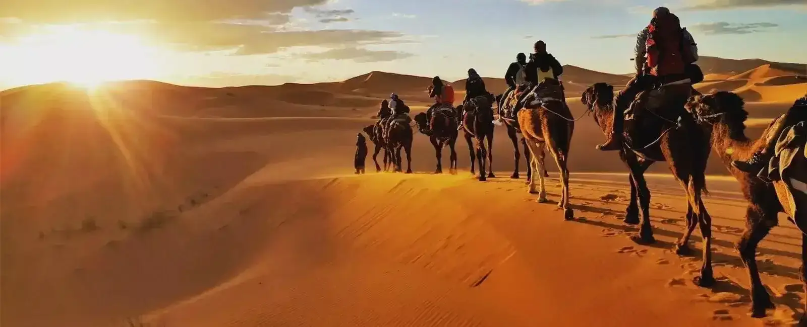
The drive from Marrakech to Merzouga (the most popular Sahara dunes) takes 9–10 hours via Ouarzazate and the Tichka Pass — we always split it across two days, overnighting in the Dades or Todra gorges. Marrakech to Erg Chigaga via Zagora takes 8–9 hours, also best split. Marrakech to Ouarzazate alone is 4 hours over a stunning High Atlas pass.

Jbel Toubkal, in the High Atlas south of Marrakech, rises to 4,165 metres (13,665 feet). It is the highest peak in North Africa and is snow-covered from December through April. A guided trek to the summit takes two to three days from the village of Imlil.

Casablanca to Marrakech is 238 km (148 miles) — about 2.5 to 3 hours on the modern A7 toll motorway. This is one of the easiest drives in Morocco. Fast trains (ONCF) also run the route in around 2 hours 45 minutes.

Yes — the High Atlas and Middle Atlas mountains receive significant snowfall from December through March. Oukaïmeden (south of Marrakech) and Ifrane (in the Middle Atlas) are both popular ski resorts. The Atlas peaks are visible from Marrakech on clear winter days, dusted white above the palm groves.

Morocco uses GMT+1 year-round (Morocco abolished daylight saving in 2018). That puts Morocco one hour ahead of the UK in winter, the same as the UK in summer, four to five hours ahead of New York/Toronto, and seven to eight hours ahead of Los Angeles/Vancouver.

The two official languages are Arabic (specifically Moroccan Darija, plus Modern Standard Arabic for official use) and Berber (Tamazight). French is widely spoken in business, education, and government as a legacy of the French protectorate. English is increasingly common in tourist areas, hotels, and among younger Moroccans. See our free Moroccan Arabic phrasebook for travel-ready basics.

Let Us Build the Perfect Route for You

Every Gateway2Morocco itinerary is paced around the geography — realistic drive times, the right season for each region, and rest days in the right places. 100% private, fully customisable, designed by Moroccan specialists.

A Final Word

Morocco's Geography Is the Itinerary

From the Atlantic surf at Essaouira, over the snow-capped High Atlas, down through the Draa palm groves to the dunes of Merzouga — Morocco fits four continents' worth of landscape into a single country the size of California. Once you know the distances, the climate, and the mountain passes, you have everything you need to plan a trip that feels effortless on the ground.